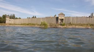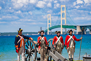
Situated on the Straits of Mackinac, Michilimackinac was ideally located to serve as a major transshipment point and resupply hub for the Great Lakes fur trade. Every summer, dozens of canoes and a few small sailing vessels filled with tons of fur, trade goods, food, and other supplies called at the shoreline community. To facilitate movement between water and land, by at least the mid-1760s Michilimackinac’s residents relied upon a wooden wharf.
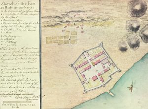
It is unclear when the shoreline community first constructed a wharf. Although he left a detailed written description, and the first known map of Michilimackinac, after his October 1749 visit, French military engineer Michel Chartier de Lotbinière did not mention or draw any type of dock near the fort. It is entirely possible that the many canoes and bateaus which called at the post were simply hauled onto the beach by hand during the French period. The first good visual depiction of a Michilimackinac wharf came in 1765, when Lieutenant Perkins Magra of the 15th Regiment mapped the fort for his British superiors. The wharf depicted by Magra was not particularly long, appearing to reach less than 50 feet into the water. A similarly-sized wharf appeared on a second, anonymously drawn map of Michilimackinac created between 1766 and 1769.

The wharf drawn by Magra in 1765 was likely an older structure, constructed by the French in the last years of their occupation of Michilimackinac. An official request for improvements to the post, submitted to General Thomas Gage in October 1765, included a new wharf among the many projects that British officers hoped to undertake at Michilimackinac. Repairs were likely carried out in 1766. In any case, some small boats, at least, continued to be simply beached on the shoreline, rather than tied up at a wharf. In 1774 Captain John Vattas of the 10th Regiment supervised the construction of a series of rollers used to more easily winch bateaus and other small craft out of the water. If the rebuilt wharf still existed in the same configuration as drawn by Magra, it was likely not long enough to reach deep water and provide dock space for the few small sailing vessels on the upper Great Lakes. Passengers and cargo were transferred to smaller boats for the trip between the vessel and the wharf. In June 1774, an artilleryman named James Lewis drowned while attempting to come ashore at Michilimackinac from the sloop Chippewa. Lewis fell overboard while pushing a small boat away from the vessel and was never seen again. Ironically, Lewis had traveled to Michilimackinac as a replacement for another artilleryman who also drowned.
The wharf was not among the structures removed to Mackinac Island at the end of the 1770s. Indeed, the first task Lieutenant Governor Patrick Sinclair assigned to the men dispatched to the island in October 1779 was the construction of a wharf. The Mackinac Island wharf eventually measured at least 150 feet long, and was located near the modern Mackinac Island State Park Visitor’s Center.
Today, although the Michilimackinac wharf no longer remains, its presence in the 18th century is an important reminder that Michilimackinac was very much a maritime community, reliant upon the Great Lakes to transport the people and goods that allowed the post to thrive.
Thanks to Lynn Evans and Keith Widder for their assistance with this post.


