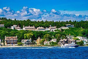

Every year, thousands of people come to Mackinac Island and visit such well-known places as Arch Rock, British Landing, Sugar Loaf, and Fort Mackinac. But have you ever visited Desha Mound, Langlade Craig, Echo Grotto, or Raymbault Height? These are just a few of the 212 named “places of interest” on the island listed by the Michigan Historical Commission in a 1916 travel bulletin.
Written by Frank O’Brien, the president of the Historical Commission, the small booklet was intended to “enable tourists to enjoy the various sights on the Island.” O’Brien did not aspire to write a new history of Mackinac, as he acknowledged that dozens of such works already existed, but provided each location with a brief description and a bit of historical background. In writing the guidebook, he utilized existing and historic names for some places, such as Biddle Point and Leslie Avenue, while creating entirely new names for others.
Many of the places identified by the guidebook remain well-known island landmarks, but others are definitely more obscure, and modern visitors might be hard-pressed to locate them. Some are located on private property. A few, such as Fairy Arch, the deer park, Rese Road, Gratiot Trail, and Scott’s Cave, simply do not exist anymore, having fallen prey to natural forces or 20th century human development on the island (Fairy Arch and Scott’s Cave were destroyed during erosion control efforts after World War II, the state park deer park behind Fort Mackinac was closed, and Rese Road and Gratiot Trail were obliterated by the construction of the Mackinac Island airport). Others are such minor “landmarks” that visitors may pass them without realizing that they ever warranted a formal name. Sinclair Grove, for example, was the name assigned to a “grove of arbor vitae” just east of Fort Mackinac. The Coureur de Bois Shelter, meanwhile, was described as a “natural spot of refuge; a knoll on bluff edge on path to Robinson’s Folly.”
In any case, the 1916 guidebook makes for an enjoyable look at tourism on Mackinac Island over a century ago. Enterprising modern visitors might want to see how many of the 212 named places they can find today!
(In case you were wondering: Desha Mound was a “small mound or knoll affording a fine vista of trees” in the vicinity of the Wawashkamo Golf Course and named after an American officer wounded in the Battle of Mackinac Island in 1814; Langlade Craig was a “projecting craig [large rock] above Hennepin Point, being about 40 feet high and of broken limestone” honoring Michilimackinac merchant Charles Langlade and located on the cliffs above M-185 near Arch Rock; Echo Grotto was a “recession of the bluff” between Robinson’s Folly and Dwightwood Spring where “visitors will note the echo of boat whistles; and Raymbault Height was a “view-point on the east bluff” located along Leslie Avenue and named after a 17th century Jesuit priest.)